‘History is about maps’, Honest History, 2 December 2014
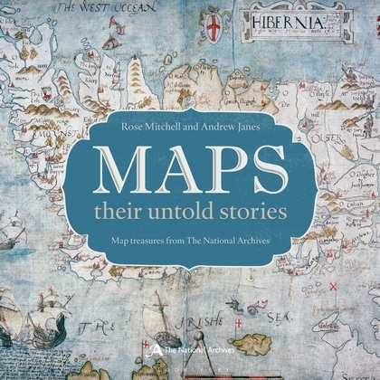
Steve Flora reviews Maps: their Untold Stories: Map Treasures from the National Archives, edited by Rose Mitchell and Andrew Janes, and notes some other recent cartographical arrivals
It used to be said that ‘geography was about maps and history was about chaps’. Apart from the gender error, that has clearly always been wrong. Maps have always given history a special (as well as a spatial) dimension and that is still the case today. Studied alongside historical narratives, maps offer us a better understanding of both history and society. The resulting synergy gives greater insights than either maps or history in isolation. A much stronger grasp of the ‘how’ and ‘why’ and ‘where’ of history becomes possible.
 On the other hand, maps themselves can be the story, by the mere fact of their surviving the vagaries of time. Maps: their Untold Stories attempts to cover many of these aspects, focusing on a selection of one hundred maps from the National Archives collection at Kew. The authors, both Public Records Office map archivists, present some interesting observations, facts and stories regarding the documents they have chosen to highlight, particularly on the older maps. Many of the maps are relevant to Australian history, broadly defined, and all of them are relevant to how history is used and to the teaching of history.
They [the maps] give clues to help unlock the mysteries of the countryside by providing evidence that features existed and what they looked like at a point in time, and they help us to picture how people lived and worked in past places. Where new towns have arisen and cities expanded over the centuries, earlier maps serve as a record of fields and woods before they were lost under a sea of brick and stone.
This is certainly a most valid reason for the preservation and studying of the older documents, even if at times these documents are filled with inaccuracies. They still provide insights into what existed prior to the ability of photography to capture vast swathes of landscape.
On page 118, for example, is a map that is ‘the oldest in the archives to show a military operation in the skies’. It is part of a proposal made in 1800 by Charles Rogier, showing how balloons carrying rockets could be used to cross the Channel to attack the French around Brest. The concept was not embraced but it reflects upon the situation at the time and provides portents of the future.
A map from New Zealand shows an incident on 11 February 1864 during the Waikato War between the Maoris and British. The map is interesting for a number of reasons, because it was drawn by Charles Heaphy to support his successful claim for a Victoria Cross, for the features of the area it shows, and for the light it casts upon Maori society.
Maps: their Untold Stories includes tales of the often whimsical survival of documents. For example, there is a fourteenth century mariners ‘compass’ map which was used as a recycled cover for a Tudor Exchequer customs account and was only found in the mid-twentieth century. Then we read about the ‘rare survival’ of Captain Greenvile Collins’s hand-written seventeeth century master’s log (with hand-drawn maps) being bought ‘off a stall’ over a hundred years after his death.
One of the more enthralling documents in the book is the 1793 ‘oldest known Maori map of New Zealand’, drawn by two Maori men, Tuki Tahua and Huru, who were kidnapped by Governor Philip Gidley King. Then there is the hand-drawn map of the Hong Kong New Territories, a map on which the expansion of the British colony was based, with its ‘99 year lease’ arrangement. Both of these maps are notable for their clarity of reproduction.
A world map produced in Germany in 1915 entitled ‘The historical development of the British Empire’ shows the extent of the British Empire, with a legend relating when and how Britain acquired each possession.
A notable omission from the map as printed [say the editors] is any indication of the colonies held by other European powers. These blank spaces of non-British territory cleverly convey the false impression that land-grabbing imperialism was a uniquely British phenomenon.
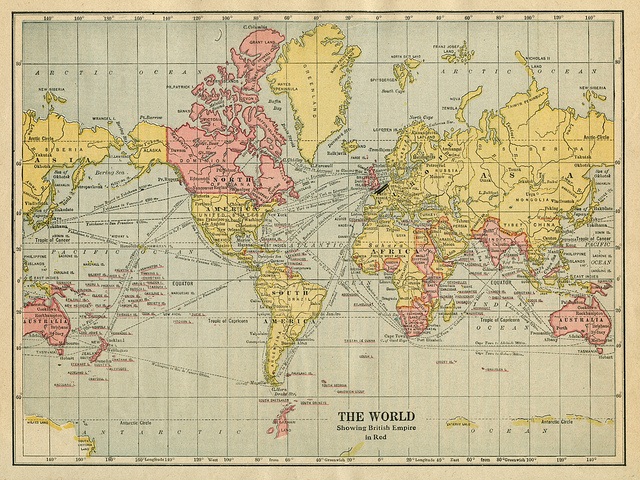
This was an example of a map used as propaganda tool. On British maps, the red bits for the Empire served the same purpose.
 The World, showing British Empire in red, 1922, Ontario Public School Geography (Flickr Commons/Eric Fischer)
There is a strong world war link also in the ‘English Delegation Copy’ of a 1938 map showing the post-World War I creation, Czechoslovakia. The map, labelled ‘Volksgruppen in der Tschechoslowakei’ (‘Ethnic groups in Czechoslovakia’), is a large one reproduced on a small scale, making it difficult to decypher. The details of how it came to be in the PRO, the intrigue of what its colours represent, along with handwritten notes, are still fascinating. Given by Hitler to Neville Chamberlain, it shows German territorial demands on the Sudetenland. Hitler’s accompanying promise not to claim further territory was broken a year later, leading to the start of World War II (or the resumption of World War I). The map evokes the history of Europe from 1890 to 1945, if not to the present.
The World War II link continues with a copy of one of the 650 maps that formed part of the ‘Bomb census survey’ project of the British Ministry of Home Security, initially for the London Blitz of 1940 to 1941. The editors add a fascinating note which makes these bombing maps even more a part of history.
Bomb sites were plotted onto these base maps by hand. Diagonal dashed lines symbolize showers of small incendiary bombs. Individual high-explosive devices are marked with dots; those thought to have been dropped in sequence from the same aeroplane are linked together. The circles with crosses represent the sites of unexploded bombs.
It is fascinating that, in the middle of such major destruction and uncertainty, archival record- keeping carried on. The value of such a combination of maps and records was recognised early and the census was extended to the rest of the country for the duration of the war. ‘The recordkeeping became more detailed as … the government’s thoughts began to turn towards post-war reconstruction.’
Such standouts do not, however, counter the less than satisfying overall work. The book is a disappointing and often slow read, interspersed with some examples of gripping maps and interesting text. My disappointment is mainly due to the weak visual aspects: the reproduction of larger maps are often in too small dimensions and sometimes in soft focus, making them difficult to read, even with a magnifying glass. Highlighted details are often hard to find in the map itself and are sometimes left off entirely, as the whole map is not included in the book. When these negatives are combined with some disconcerting typographical errors (hinting at less than adequate editorial oversight) the overall effect is further blemished. The maps, their contexts and their histories are worthy of better.
While Mitchell and Janes were rather let down by their editor, publisher and printer, all sorts of maps are flourishing elsewhere. From the British Library comes A History of the Twentieth Century in 100 Maps, by Tom Harper, which looks somewhat like a direct competitor for Mitchell and Janes. Harper’s book is nicely extracted in The Guardian with lots of photographs and includes a 1907 map of the world drug trade, occupied Paris 1940 and the Beatles’ Liverpool 1974.
 Political map, Liberal Party of Australia, 1966 federal election (Tom Nichols, The War Room blog)
From The Guardian also there is a map of Australian regional differences in how common objects are designated. So, if you need to know where the people you are with will cotton on to what you are talking about when you mention ‘cozzies’, ‘ports’, ‘bubblers’ and ‘fritz’, this map will help. Much more serious is an article from Philip and Jacqueline Clarke on early maps of Australia, based on an exhibition earlier this year at the National Library of Australia and referring to a number of maps now readily available on the internet. This article nicely complements the resource put together by the National Library and the University of Melbourne on the Australia-related maps from John Arrowsmith’s London Atlas, which was published in successive editions from 1834 until 1858.
Finally, not a map exactly but fascinating nevertheless is Google Street View’s venture onto the Barrier Reef. While the Reef is still there you can click on about 15 locations and pan around three dimensional photographs (still but remarkably clear) of the reef and its inhabitants, including close-up views. There may be a way to turn these images into desktops for your computer but we couldn’t find it. Still, it makes a restful change.


It is interesting that while detailed maps of the effects of bombing raids on London during the Blitz were being born, those same raids resulted in the loss of many British First World War military records. An endless merry-go-round of creation and destruction … sigh.